Direction Convention of Environmental Conditions
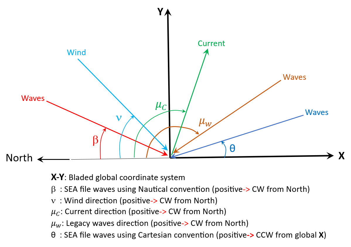
Figure 1 shows the direction of wave, wind and current. The coordinate system in Figure 1, used for the wave and current calculations, is a right-handed Cartesian system in which \(X-Y\) plane is in global coordinate system. In this coordinate system, North direction points to the negative of global X-axis. The origin is at the mean water level (no tide correction) and z-axis points upwards. In Nautical convention, angles are defined relative to the x-axis (North) and increase positively toward the East (in clockwise).
Last updated 30-08-2024