Forestry
WindFarmer accepts forestry height information in common raster formats, like *.tiff, *.xyz, *.grd. The input raster should contain one band only, which carries information on tree height over the terrain, in meters or decimeters.
 |
Import a forestry file | Roughness data can be imported from common raster file formats like .tiff or .grd. |
However, it is not uncommon for analysts to prepare forestry maps in vector form, as closed lines or polygons for example, each encapsulating a forestry patch having similar, known height.
In the case such input is available it will be necessary to convert that vector information into its equivalent raster form, prior to loading it into WindFarmer.
This can be easily achieved using, among others, the open-source and free QGIS software package.
Below are a few steps leading to a successful format conversion (prepared in QGIS version 3.22.7):
Download and install the latest QGIS Desktop client from gis.org. Open a new Project.
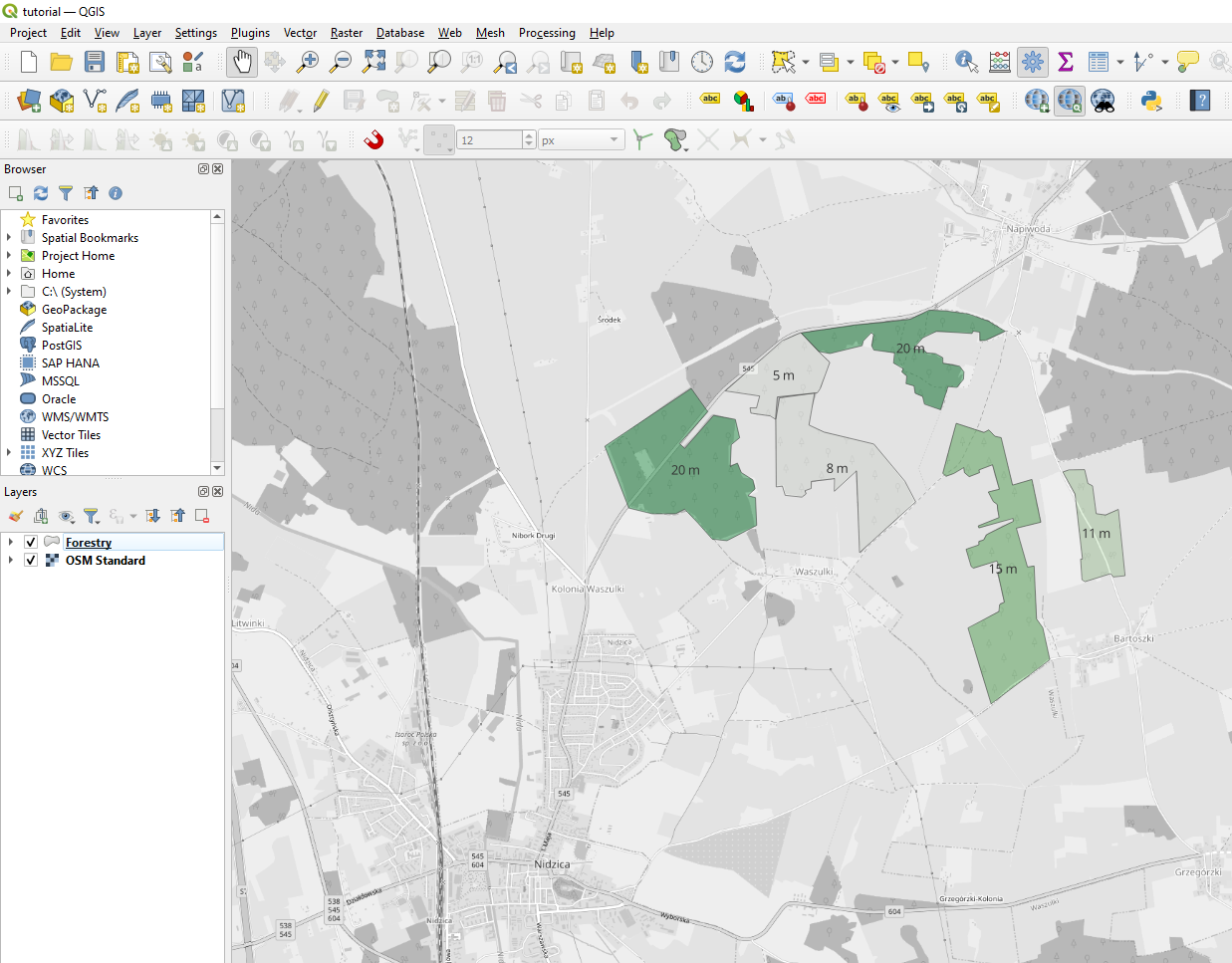
Load the vector layer into QGIS by selecting Layer > Add Layer > Add Vector Layer from the drop-down menu at the top of the QGIS window. Then browse the relevant file, load the layer and set the display options (optional), for example along these lines:
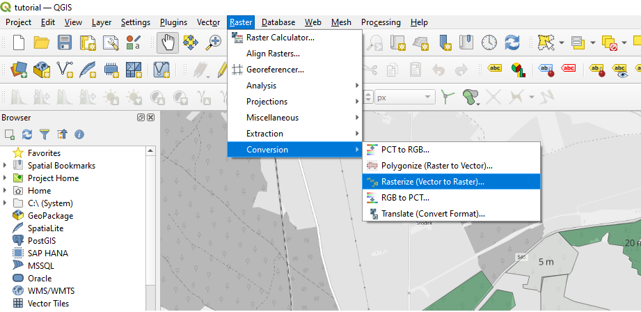
Then, navigate to Raster > Conversion > Rasterize (Vector to Raster)
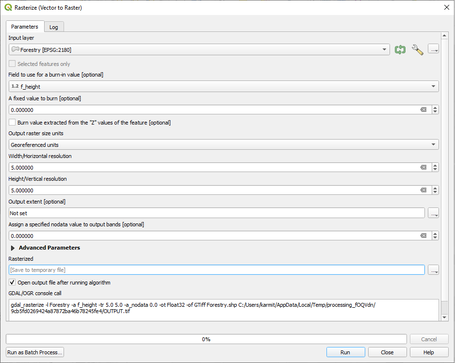
Populate the dialogue with conversion algorithm settings as suggested below. Try to strike a good balance when setting the raster resolution. Depending on the forestry extents and shape, setting resolution too high may impede the speed of displacement height calculation. Setting resolution too low will impact the accuracy. It is recommended to define a rectangular grid. When ready, click “Run”.
A temporary raster layer is created in the project tree. In the example below its display style has been defined to mimic the vector layer style (value dependent pseudocolor), but this optional and irrelevant in the context of the conversion. Right-click the rasterized layer and select Export > Save As:
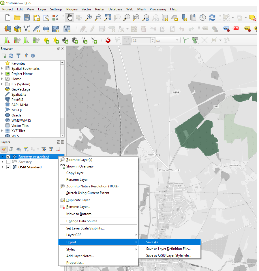
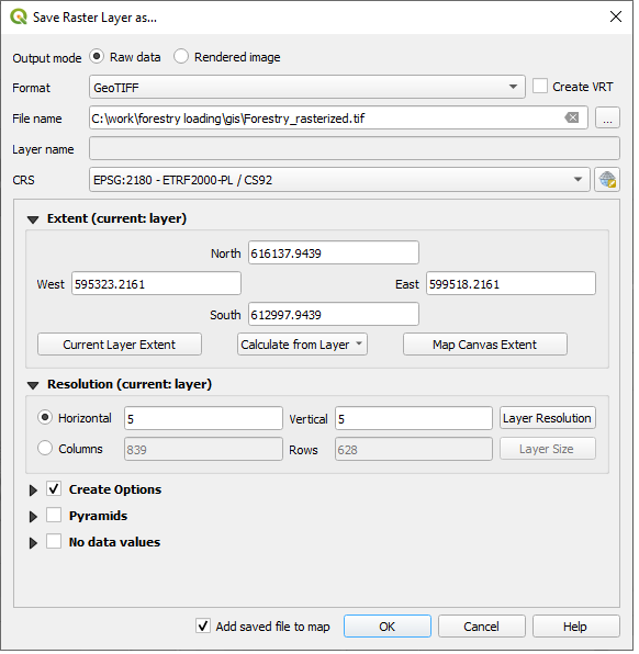
Inspect the export settings in the pop-up menu, the file format and coordinate system in particular. WindFarmer accepts *.tiff and *.grd formats. Click “Ok”.
Once the file is succesfully loaded the forestry flow displacement calculations may be performed in Flow > Forestry displacement.
Note
Depending on whether you load the forestry file in the GUI or via the scripting interface you can either be prompted to specify the forestry height measurement units (GUI) or have this set to default meters (scripting).
Note
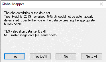
If the datatype of the single-band raster is set to FLOAT32 or FLOAT64 the following prompt may appear when loaded from the scripting interface, in which case click “Yes”.
In order avoid it, for example when batch running many projects in an automated manner, set the forestry raster’s datatype to INT16 or INT32, which should be precise enough for most applications.
This behaviour will be changed in future releases with no prompt irrespective of the datatype.
